
Subscribe to our "Population in Perspective" Substack Here!
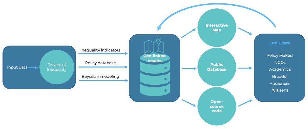
Researchers from the Leverhulme Centre for Demographic Science are developing Mapineq Link, an open-access interactive data dashboard and database with API access that will revolutionise inequality and life course research.
This innovative platform, to be launched fully in autumn 2023, enables interactive data exploration and seamless integration of diverse geo-linked policies, social and economic indicators, as well as environmental measure from remote sensing, digital traces from online activity, and other non-traditional data sources into researchers' projects, fostering collaboration within and beyond the Mapineq initiative.
The ‘Mapping inequalities through the life course’ project, known as Mapineq, addresses the pressing challenge set by the European Union to identify and combat the key drivers of inequality trends. Developed by the Leverhulme Centre for Demographic Science together with a consortium of project partners, Mapineq Link aims to understand how these inequalities accumulate and are influenced by structural, institutional, and policy factors at various levels.
Mapineq Link is an open-access interactive dashboard and geospatial database equipped with an API, designed as part of the EU-funded Mapineq project. This inequality database will empower researchers to seamlessly connect a wide range of geo-linked indicators to their own projects, facilitating impactful research within the Mapineq community and beyond. Mapineq Link will also promote public engagement and provide policymakers with vital insights, facilitate data retrieval for programmers and data scientists, and enable seamless integration for external web developers.
Dr Douglas Leasure, project partner and Senior Researcher and Data Scientist at the Centre said, ‘The Mapineq Link geospatial database revolutionises inequality research by leveraging the power of 'place' to connect diverse data sources. We combine traditional indicators with innovative data from remote sensing to online digital traces, providing a deeper understanding of inequality drivers at local and national levels. We are also dedicated to upholding FAIR principles for both our data and code, ensuring the accessibility and reusability of our innovations.’
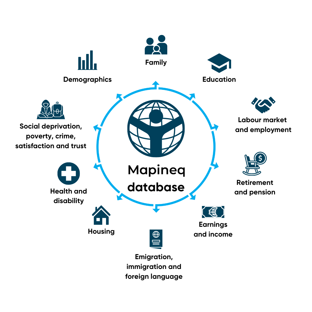
Phase 1 of the Mapineq Link database has been unveiled, featuring ten thematic modules encompassing crucial policy indicators across multiple domains, including social, economic, societal, and demographic factors. These sources will be refined and expanded as the resource develops.
By providing access to comprehensive data and facilitating the integration of various policy indicators, Mapineq Link will equip researchers with valuable insights into the drivers and trends of inequalities, empowering them to develop effective interventions that address and diminish disparities in our society.
Professor Melinda Mills, project lead and Director of the Leverhulme Centre for Demographic Science concludes, ‘Mapineq Link will equip policy makers and researchers with the fine-grained geospatial data needed to revolutionise our understanding of how an individual's local context influences inequalities. We go beyond standard demographic, economic and social policy measures, mapping local contextual inequalities to health and housing data. Future plans include incorporating environmental factors like pollution and light, as well as infrastructure data such as green space.’
Phase 1 of the MapIneq Link policy database is out, with Phase 2 and the online data dashboard and API to be launched in autumn 2023.